Take on a demanding day hike to reach the summit of the highest peak in the Rocky Mountains and the second highest peak in the lower 48. Towering at 14,433 feet, Mount Elbert offers hikers with stunning 360-degree views of a seemingly endless sea of peaks from its rocky summit, making it a must-do hike for all who can get there.


Trailhead elevation 10,061'
Water Elbert Creek
Don't miss identifying the numerous 14,000-foot peaks from the summit
Hike Mount Elbert via North Mount Elbert Trail
From the trailhead, the path initially winds its way up the mountain's northern slope, following the Continental Divide Trail/Colorado Trail. The first mile accumulates less than 600 feet in elevation gain while traversing a densely wooded area composed of Ponderosa pine, spruce, aspen, and fir trees. During this stretch, hikers will cross Elbert Creek, the route's lone water source.

After navigating through several switchbacks, at approximately 1.2 miles into the hike, the Continental Divide Trail/Colorado Trail intersects with the North Mount Elbert Trail, which hikers will use to reach the summit. Over the next 1.8 miles, the trail continues to ascend steadily through a similar environment, offering limited glimpses of the surrounding landscape.

Around the 3-mile mark, the trail transitions into an alpine landscape steepen considerably. Over the next mile, the trail gains more than 1,300 feet in elevation, making it the most challenging segment of the hike. Along this section, hikers catch sight of the first of two false summits on the mountain, shrouded in cloud cover in the photo below.

A short distance later, the trail breaks the tree line, giving way to a view of the route leading to the first false summit. From this point onward, hikers can expect the wind to pick up noticeably and the temperature to drop. In addition to rain and lightning, snow is also common on the peak, and cases of hypothermia have been documented even during the summer season. For that reason, hikers are wise to bring an added layer.

Over the course of the next mile, the trail gains a respectable 1,200 feet, offering views of Twin Lakes, the Mount Elbert Forebay Reservoir, and distant sights of the Collegiate and Buffalo Peaks to the southeast. To the northwest across Halfmoon Creek, Mount Massive, the second highest peak in Colorado, along with numerous 13,000-foot peaks come into view.

About half a mile after the trail breaks the tree line, it shifts from a firm dirt path to a trail littered with scree, often causing the pace of the hike to slow. From this point forward, hiking poles can prove very helpful. Once beyond the mountain's second false summit, the actual summit comes into view. After a final push, hikers arrive at the summit, greeted by panoramic 360-degree views from the highest peak in the Rocky Mountains.

From the summit, hikers are treated to views of numerous 14,000-foot peaks. To the south, Missouri Mountain (14,074'), La Plata Peak (14,360'), Redcloud Peak (14,041'), Uncompahgre Peak (14,309'), Mount Harvard (14,421'), Mount Bedford (14,204'), Mount Princeton (14,204'), Mount Yale (14,202'), Mount Oxford (14,160'), Mount Columbia (14,079'), Huron Peak (14,012), and others. To the north, Mount Massive stands prominently among several 13,000-foot peaks, towering at 14,421 feet. Those interested in snagging a cheesy photo with a "Mount Elbert 14,433" sign, will often find numerous signs wedged between rocks at the summit.

Mount Elbert was named in honor of Samuel Hitt Elbert (1833-1899), who held several distinguished roles including Territorial Secretary of Colorado, Territorial Governor of Colorado, and State Supreme Court Justice from 1862 to 1888. Revered for his leadership, Elbert played a pivotal role in advancing innovative irrigation methods and pioneering conservation ideas far beyond his era. Following his successful negotiation of the Burnot Agreement of 1873 with the Ute, permitting railroad and mining access to certain lands, miners bestowed the peak with his name in September 1873.
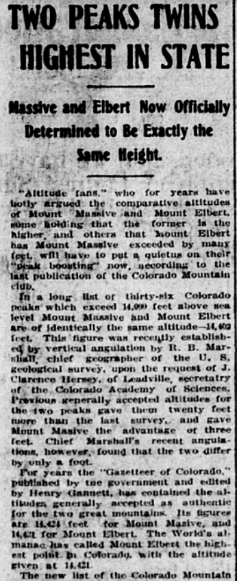
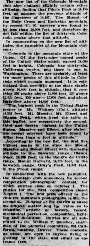
Throughout the early 1900s, Mount Elbert was a point of contention among locals. Some believed that it held the distinction of being the tallest mountain in Colorado, while others argued that it was neighboring Mount Massive that reigned supreme. Several geological surveys conducted during the 1910s, 1920s, and 1930s utilized various measurement techniques to assess the peaks leading to mixed results. Mount Elbert appeared taller in certain surveys, whereas Mount Massive claimed the title in others. A survey in 1913 even asserted that the two mountains shared identical heights.
In 1939, upon discovering that authorities had once and for all declared Mount Elbert taller by 6 feet, Mike Costello and Seamus Hennessy, two local minors who believed in Mount Massive's superiority, took matters into their own hands. Scaling Mount Massive with Costello's new battery operated radio, they erected a 7-foot-tall rock cairn at the summit, declaring it the tallest mountain in Colorado by 1 foot. As the two men celebrated their victory, they listened to Costello's radio, proudly proclaiming themselves the first to enjoy a radio broadcast from Colorado's highest peak. A newspaper article dated December 11, 1939, tells the story.

In the ensuing years, the spirited debate persisted. Advocates of Mount Elbert eventually ascended Massive's summit and dismantled the rock cairn in defiance, prompting Mount Massive supporters to reconstruct it. This cycle repeated itself over decades: the cairn erected, torn down, rebuilt, torn down again, and so forth. Despite the endeavors of Mount Massive proponents, Mount Elbert remains the tallest peak in Colorado, standing tall at an impressive and official 14,433 feet.
Truth be told, the hike up to the summit isn't the most scenic, but the views at the top more than make up for the lack of scenery along the way. And, with it being the tallest peak in the Rockies, it's hard to say no to it. As an out-and-back, hikers simply retrace their steps back to the trailhead after taking in the views.
_edited.png)


Comments