Located amid the scenic landscapes of Chillicothe, Ohio, the ancient Junction and Steel Earthworks continue to fascinate the minds of archaeologists and historians. These meticulously crafted sites, built by the Hopewell—a Native American culture that thrived around 2,000 years ago and was centered in what is now Chillicothe—span nearly 100 acres and are connected by a footpath today. The earthworks display a complex array of mounds and enclosures arranged in various geometric patterns, including circles, crescents, squares, and a rare quatrefoil. These enclosures are believed to have served as sacred ceremonial sites, bearing witness to numerous rituals and celebrations during the peak of the Hopewell culture.

A Brief History of the Hopewell Culture
Before visiting Junction & Steel Earthworks, it is helpful to familiarize yourself with the identity of the Hopewell people, their customs, and the historical significance that surrounds them.
The Hopewell culture was not a single tribe, rather a vast network of prehistoric Native American societies that thrived in parts of eastern North America from 100 BC to 500 AD, during what is known as the Middle Woodland period. The primarily hunter-gatherer civilization was renowned for its extensive trade networks, sophisticated artistry, and large-scale earthworks. They were primarily centered in the region around the Ohio River Valley, but had a widespread influence across a vast area that included parts of present-day Illinois, Indiana, Kentucky, Michigan, Wisconsin, and as far south as the Gulf Coast and Florida.
Well-known for their expansive trade networks covering thousands of miles, the Hopewell engaged in the exchange of precious resources like copper, mica, shells, obsidian and other exotic materials across far-reaching distances. Archaeological evidence confirms this, as artifacts like obsidian spearheads from Wyoming and various copper items from Lake Superior have been unearthed at archaeological sites in southern Ohio.
The legacy of the Hopewell culture is best exemplified by its monumental earthworks and predominantly conical shaped mounds, which served various purposes as burial sites, ceremonial centers, and markers for celestial events. Their architectural achievements were awe-inspiring, with many of the structures ranking among the largest non-fortification or defensive structures in the world. For perspective, a single Hopewell earthwork could contain the Great Pyramid of Giza, once the largest man-made structure in the world, and another could accommodate four structures the size of the Colosseum of Rome.
The Hopewell demonstrated remarkable proficiency in mathematics. Early archaeological studies have revealed compelling evidence that multiple earthworks exhibit striking similarities in their measurements. Notably, the enclosure walls of five distinct square-shaped earthworks, scattered across southern Ohio and located dozens of miles apart, all precisely measure 1,080 feet in length. Additionally, at three other sites, evidence points to nearly perfect circle enclosure walls, each measuring exactly 1,054 feet in diameter, further exemplifying their advanced mathematical knowledge.
Their expertise extended beyond geometry, as they showcased a sophisticated understanding of astronomy within their earthworks. A prime illustration of this can be found in the octagon and circle combinations at two distinct complexes. These earthworks feature precise alignments to key points on the horizon where the moon rises and sets during its 18.6-year-long cycle. The discovery of this celestial cycle indicates that Hopewell sky-watchers engaged in systematic observations of the moon for several generations, demonstrating their profound knowledge and dedication to studying the cosmos. In more recent times, it was discovered that the Fort Ancient Earthworks not only served as a ceremonial site, but also as an astronomical calendar.
Around 500 AD, the Hopewell culture experienced a notable decline, marked by the cessation of trade, earthwork, and mound construction, as well as the discontinuation of their characteristic art forms. The specific reasons behind this decline remain a mystery, but archaeologists have explored possibilities such as changes in trade patterns, shifts in the environment, and social transformations as potential contributing factors.
What the Hopewell called themselves and what language they spoke is unknown. Like many ancient civilizations, evidence of their written language, if in fact there was one, has yet to be discovered. Similar to many newly unearthed civilizations, the Hopewell culture got its name from the location where its artifacts were first discovered. Therefore, it was named after the field in, once owned by Chillicothe, Ohio native Mordecai Cloud Hopewell in the 1800s, where the first evidence of their ancient culture was found and where the Hopewell Mound Group in Hopewell Culture National Historical Park stands today.
Visiting Junction Earthworks
Junction Earthworks derives its name from its location, where Paint Creek and the North Fork of Paint Creek converge. Located at 1143 Township Hwy 377 in Chillicothe, Ohio, the nearly 20-acre site was built 2,000 years ago and originally consisted of five earthen mounds and eight enclosures, including four circles, three crescents, and one square, all featuring water-retaining ditches inside their perimeters. At their prominence, Junction Earthworks are believed to have stood between three and seven feet tall. Yet, centuries of agricultural activity have eroded the ancient earthworks, leaving traces only beneath the surface.
However, today, through advancements in magnetic surveying and interpretive mowing techniques, the original positions of the mounds and enclosures have been unveiled, affording visitors a glimpse into the site reminiscent of its appearance millennia ago.
Upon arriving at the site, visitors will find an information kiosk providing details on the site's layout, historical background, and insights into the Hopewell culture. Adjacent to the kiosk lies the half-mile interpretive Earthworks Trail, guiding visitors through the eight visible enclosures.

The trail begins along the site's western edge, passing by a single circular enclosure believed to have housed structures, possibly temples.

Immediately following this enclosure are two additional circular enclosures surrounding the former location of a clover-shaped earthen mound, a shape referred to as a quatrefoil.

Initially misidentified as a square enclosure (highlighted in yellow below) by early archaeologists Ephraim Squier and Edwin Davis during their 1845 survey, modern technology capable of penetrating beneath the ground's surface has revealed the true form of the mound as a quatrefoil. Today, Junction Earthworks stands as the sole Hopewell site in North America showcasing this unique design. What it was intended to represent remains a mystery to archaeologists.

Continuing along the trail, it passes two crescent-shaped enclosures and a third circular enclosure. During the 1845 survey conducted by Squier and Davis, they documented a 7-foot-high, 45-feet-in-diameter burial mound along the western edge of the first crescent. In October 1845, this mound underwent excavation, revealing four Native American skeletons. Notably, three of these skeletons were well-preserved and positioned side-by-side with their heads facing east. Furthermore, a burned altar was uncovered, suggesting the site's use for religious ceremonies such as cremations. Atop the altar, various relics akin to those found within the mounds at Hopewell Culture National Historical Park were also unearthed. Today, there is no trace of the mound.

After the circular enclosure, the trail leads to the easternmost and largest enclosure of the site, a large square measuring 240 feet. What has struck curiosity in archaeologists familiar with Hopewell earthworks building practices lies in the enclosure's design: the exterior wall features rounded corners, creating an almost circular shape, while the interior once formed a precise square. Archaeologists believe this design was intentionally crafted, although the exact purpose remains a subject of speculation.

Following the square enclosure, the path leads to a third crescent enclosure. There is speculation that this enclosure, along with its counterpart directly opposite, might have been utilized for organizing celebratory games. However, as of yet, no evidence has surfaced to substantiate the theory.

From the third crescent, the trail continues for a short distance until reaching the trailhead, thus completing the loop of the site.
The site's preservation owes much to the efforts of Arc of Appalachia, alongside Heartland Earthworks Conservancy, The Archaeological Conservancy, Rivers Unlimited, and the Central Ohio Preservation Society, who secured the site for $65,000 in 2014, when it went up for sale, preventing it from falling into potential real estate developer hands. Their dedication has safeguarded Junction Earthworks from potential destruction and secured its legacy for generations to come.


Visiting Steel Earthworks
Located on a stream terrace overlooking the North Fork of Paint Creek, one mile northwest of Junction Earthworks and roughly 4.5 miles downstream from the Hopewell Mound Group, lies Steel Earthworks, a more than 70-acre Hopewell culture complex once featuring at least ten earthen enclosures of various shapes, nine wooden structures, and at least one burial mound.
The site was first surveyed by Squier and Davis in the 1840s, and featured in their Map of Twelve Miles of the Scioto Valley with Its Ancient Monuments. However, during their mapping of the complex, they only noted two small enclosures and a small mound, omitting at least eight enclosures.

Nearly 70 years later, a map of the site appeared in Archaeological Atlas of Ohio and featured five enclosures. However, it wasn't until 2017, when archaeologist Jarrod Burks performed a magnetic gradient survey of Steel Earthworks, that all of the enclosures were discovered. The survey revealed at least ten enclosures, including a single crescent, seven squares, one circle, and a shape found at no other Hopewell culture site in North America - a diamond.

Subsequent archaeological research produced evidence that Steel Earthworks once featured at least nine woodhenges, ranging from 36 feet to 60 feet in diameter, the most woodhenges of any Hopewell site in the region. The image below, highlights the woodhenge structures (in yellow) as Jarrod Burks discovered.

Unlike the more well-known sites belonging to Hopewell Culture National Historical Park, Steel Earthworks has offered little in terms of archaeological artifacts. However, in three of the four enclosures that have been excavated, ceramic pottery and earthen ovens have been discovered.

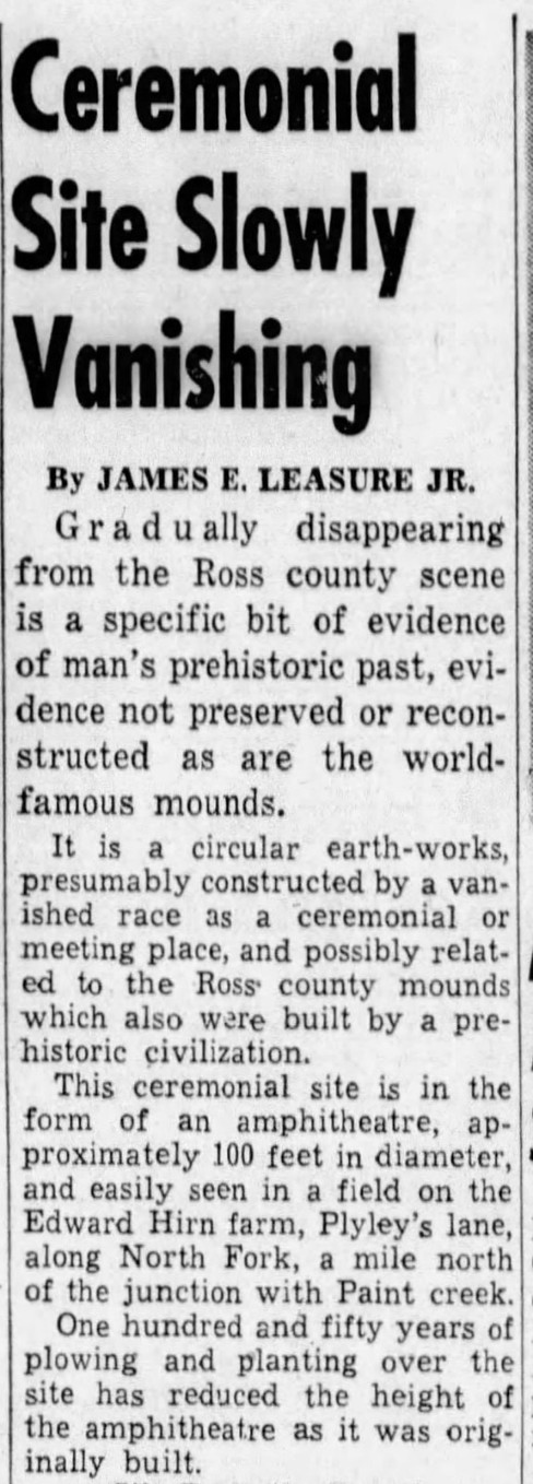
Sadly, over the last two centuries, agricultural practices such as field plowing have dramatically affected the Steel Earthworks site. Of the nine woodhenges, ten enclosures, and single burial mound, all that is visible today is a single circular enclosure. An article circulated by the Chillicothe Gazette dated January 23, 1953, briefly mentions the Steel Earthworks, which at the time were on land owned by Edward Steel.


Today, visitors can view the enclosure by walking to the site via a footpath put in place in 2022. The one mile (each way) trail follows an old railroad corridor, leading to the Steel Earthworks prairie loop where visitors can view subtle traces of the 2,000-year-old site.


Comentarios